Monday, June 21, 2010

Anamolo

ANAMOLO...Olomana backwards. YES, we did it!
Today Beimes, Justin and I conquered Olomana’s third peak from the back. It was a thrill, even scary as shit at some points, but well worth it. I wish I took more video and had my GoPro wrist camera charged for this one. It is a hike I will probably never do again, and as a single mother of two probably shouldn’t have done to begin with.

Initially we planned to do Bowman but because of time constraints decided on Olomana reverse. We have all completed the infamous third peak from the front and would agree Olomana to be one of Oahu’s more challenging trails. The hike to the first peak is killer, and the ascent and descent of both the second and third peak requires careful footing and the use of many unmaintained ropes. It also includes sheer drops definitely testing one’s fear of heights. But NONE of that comes remotely close to the climb up Olomana’s back.

Before attempting this hike we each tried to research information but came up empty. All we knew was it could be done. Luckily, Justin, a fire fighter stationed at Waimanalo, had the chance to check out the Maunawili Ditch Trail while on duty. He knew it led to the Matterhorn. Having just completed Maunawili Demonstration Trail also helped because we had an idea of how the trails connected.
Once again we parked our car at Justin’s friend’s house in Waimanalo. We exited the property, took a few short cuts through the forest, one which included the Old Kailua Ditch Trail (marked by a yellow, foam arrow), and met up with the Maunawili Ditch Trail cutting off a good 10 minutes. The trail eventually led to a fork where the left path is the Maunawili Demonstration Trail. We continued on the middle path (the Ditch Trail) through some posts and weaved through more forest steadily gaining elevation. We did enjoy a few declines only to walk up again.

About 50 minutes later we finally reached the ridge. We got our first glimpse of Waimanalo but still were not at the base of the third peak. We trekked on through a nice grove and emerged at our first real incline. The terrain was gravely and included no ropes providing a hint of what the third peak entailed. I grabbed onto the brush and imagined descending this on our return trip. I could see myself slipping and sliding and holding on for dear life. That soon changed because once on top I realized I was about to descend the slope’s back. It was sketchy but fortunately no one fell.

We continued along, and as we neared the peak’s backside could see the challenge ahead. Right away we would be using a rope to aid in our ascent. Unmaintained ropes again, and worse, we had no idea when they were last used. I stayed at a clearing to video Justin’s climb and from observing how long it took him to reach the rubber tree I knew it was no easy task. He continued up the second half of the rock face and took even longer! I was in for it. While Beimes continued up, I climbed to the rubber tree. Oh how I loved that rubber tree. I could hear Justin giving Beimes pointers on how to ascend the rocks, and as I approached the area received the same advice.
“Make sure you get good footings. Hold the rope but don’t put all your weight on it,” Justin said.
So there I was almost spread eagle against this huge smooth rock with no crevice or crack, balancing with each foot on an adjacent rock. I knew the next step was to place my left foot higher and use the rope in my left hand to pull the rest of my body upward. Only problem is I’m right handed and I know my right arm is stronger than my left.
“I don’t think my left hand will hold my body weight,” I told Justin.
“Just bring your left foot higher,” he replied.
I told myself over and over again to move my left leg, but it wouldn’t move. It just wouldn’t.
“You CAN’T bring your leg up here and bend it? I thought girls were flexible,” he said sarcastically.
“I am flexible, Justin. I can lift my leg vertically in the air but how can I bend my knee at shoulder level?” I answered back.
I brought my right leg back and stood on the little ledge shaking out my left foot.
Try two. I placed my right foot on the opposing rock. With both legs split once again I grabbed the rope with both arms and placed my weight onto it as I lifted my left leg and then right which was nearly as vertical as Justin explained earlier. With my right foot planted firmly on top, I let go of the rope and pushed myself up. I was finally done!


Or so I thought. There were THREE more insane, vertical, rope requiring, sheer drop climbs. I never put so much trust into ropes and I know I shouldn’t have, but we didn’t have any other choice. When looking from the side, Olomana’s backside is much steeper than its front. The rocks are also larger which means there are less cracks and grooves for grabbing and balancing. If that isn't bad enough, the rocks are crumbling which makes for a lot of gravel. In fact, as I balanced with the rubber tree on the first rock face gravel poured out from around it. I am not sure how much longer the lovely tree will remain intact. At another point, as I tested the strength of a rock to help pull myself up it gave way.


A little over an hour and a half into it and we were almost there. We could see the top of the third peak. All we needed to do was get over the last hump. Justin placed his foot in the rope’s noose and tried to get up but couldn’t. Beimes gave him a lift and Justin still took some time getting up. Oh wonderful I thought to myself. I knew I was going to have to step on Beimes and trust Justin to pull me up. And I do trust both of them, but standing on a platform with sheer drops to both sides hundreds of feet in the air means, like earlier, my body will not listen to me. So close and wanting to finish, I stepped onto Beimes and reached for Justin. He pulled me up with ease and I was on top without a second thought. I have no idea how Beimes got up but with Justin’s aid the three of us were on top of the third peak. In one hour and forty-seven minutes...
We conquered Olomana from behind!


During our ascent we realized there was no way we could go back the way we came. Actually, Beimes and Justin probably could do it, but that was a risk I wasn't going to take. We agreed the return trek would be like rappelling but without harnesses, and there was no way I was going to trust putting ALL my weight into those unmaintained ropes. So we headed out the normal way, down the third peak, up the second, and down the first. The climb up the back of the third peak made the rest of the hike, in regards to fear factor, zilch. It seemed exceptionally easy and on narrow ledges I found myself running. It was, however, a killer on the calves going up the second peak. We took a nice break at the first peak and completed the hike in about three hours. (To think we actually thought we were going to climb up and down Olomana's back in two, what fools!)

Olomana in reverse is in one word: EPIC.
I am so grateful to Beimes and Justin because without the two of them this and many of the other hikes I have been on would not be possible. Thanks guys!!!


Thursday, June 17, 2010

Konahuahui via Kalawahine

Konahuanui is a hike to the two highest peaks in the Koolau Mountain Range. K2, the second highest peak reaches an elevation of about 3,105 ft., while K1, the highest peak reaches a height of about 3, 150 ft. Although the first half of the hike via Kalawahine is not difficult, the second half is often overgrown and extremely muddy, requires the use of ropes, and contains portions of massive drops. However, the strenuous climb is definitely outweighed by its priceless views unlike any other.

Today Justin, Laura and I trekked to the two peaks praying that with some good planning and a little bit of luck we would get to see what so few have been able to: Konahuanui’s summit view in its entirety. At about 8:45 we meandered along Kalawahine through a well maintained and rather leveled path. The shade and cool breeze made it a nice stroll. We continued on, turning left at the Pauoa Flats junction, and then through a beautiful bamboo grove. We watched the rooty ground careful not to trip, and contoured through more forests until reaching the Nuuanu Lookout marked by a bench. We took a quick break as we enjoyed the views of Nuuanu Valley, Pali Puka, and Pali Notches. 
A faint trail past the bench marked the beginning of Konahuanui. The path was overgrown like many sites advised to keep inexperienced hikers from venturing into. However, after several yards the path returned to a well graded trail. We were fortunate, especially Laura who had on running shorts, that HTMC recently cleaned it because there were no uluhe choking the path to scratch our legs. After much more meandering, we finally came across Lulumahu Waterfall. At first we weren’t sure if it was the falls because only rocks were exposed, but as we neared, it was clear that today we would not get to see the “secret” waterfall for it was dried out. We trekked on quite disappointed about missing the much anticipated falls but our thoughts quickly shifted for that is when the real hiking began. We looked ahead to the ridge we were about to climb, and could tell that it was going to be muddy, slippery, and taxing. We took on one incline after another. Some portions of the ascent, two in particular, made me exhausted just by its appearance, and the once clear path now became overgrown and dense. 
Slowly but surely we finally made it to the cloud covered K2. Justin ventured on and as I followed wanting desperately to be atop of K1 he came back saying the mud wasn’t worth it unless there was a view. So we returned to K2 to take a few victory shots and a much needed rest. As I sat in the clouds trying to visualize the view, I asked if that way (pointing) was Kaneohe. Justin and Laura laughed as it was town side. I’ll be the first to admit I have a horrible sense of direction, and go figure because even now I can’t grasp what we should have seen. In the midst of the teasing the whites cleared and we could see the windward side. I don’t think we were ever more excited and that was it. We were headed to K1!
With K1 in sight we pushed through the mud, and the harder we tried to avoid it, the more we got covered by it. In my desperate attempt to stay clean I grabbed onto leaves and branches but it was useless. At one point my foot slipped and I couldn’t see my shoe, not even my ankle! But that didn’t stop us, and we ventured on through the insane mud and on-and-off again showers. On our way up we could see Kailua and the Mokulua Islands, and Waimanalo, Olomana, and Rabbit Island. The three peaks never looked so small. Directly below was a deadly drop and a distinct path part of the Maunawili Demonstration Trail. We could just imagine what the view from up top entailed, and about 30 minutes later finally made it to K1!!!
But...
The clouds were in full effect and we couldn’t see anything. I called my mom at home to look at the summit and predict weather or not the clouds would clear, and immediately she could not believe we were anywhere near clouds because it was such a beautiful day. She figured they would blow over as they were moving rather quickly. So we prayed and hoped for some kind of view, and explored the peak as we waited. A trail to the right veered off into the whiteness as well one to the left but that one was ribboned off. I am not sure where the trails lead to and I have no desire to find out. Even a frog statue sits atop K1 signed by many hikers who have reached the summit. I wondered who would carry such a peculiar object all the way in. 
After more waiting and wishing, a white, rectangular shaped object far below came into view. As the clouds dissipated I recognized Pali Lookout’s parking lot and...a white tour bus. I could not believe how high we were! In addition, every so often the sun shown so brightly it was hard to believe we were in the clouds. I have been in the clouds many times before but never has the sun felt like it was right there. 
Unfortunately the clouds remained and we left without a view. Although the descent was much faster than the climb it was just as crazy. I have no idea how many times I fell and everything was covered in mud! To be back on Kalawahine was a relief, and we ran out majority of the way so that Justin and Laura could make it to the NBA finals on time. In a little over two hours we were back at our car. 
A total of 5 hours and we successfully scaled the highest peak in the Koolau Mountain Range. Although I dread the mud, and believe me, there was a lot of mud, more than I have seen on any other trail, I know I will climb Konahuanui again because I have to see the view from the summit. I just have to!


Tuesday, June 15, 2010

Pali Notches II

I really miss hiking with Shas. 
Our hikes have become far and few in between which makes me enjoy this summer more than any other. I realize it is probably the last one where we will have the time and liberty to hike at all. Plus we're getting older. Soon our bodies won't be able to keep up.
Such is life...

Today was a beautiful day, a great day to scale the second notch. I didn't even think about how windy and cold the Pali always is regardless of how hot it may be at home. It reminds me that I should invest in a wind breaker to keep in my Camelbak for times like these. From our last hike up the Pali Notches I knew to take the farthest left path since it had trees and brush to aid in the ascent. Today was no different and it was still slippery but not as nearly as when Beimes and I had to grab onto grass to help us up--grass! 

Another perk of taking the left path is that it climbs the ridge line. Within a few minutes gorgeous views of Kaneohe emerged, and before we knew it Shas and I were at the open grassy area. We continued upward cautiously climbing the rock face and reaching the first notch about 15 minutes later. This time there were no clouds. In front we could see from China's Hat to Rabbit Island, and behind from Nuuanu Reservoir all the way to Downtown.

We took a nice break, briefly checked out the descent of the first notch and decided to go for the second. I have to admit the hike to it was nerve-racking, and as I carefully placed each foot and grab hold it became clear why so many people are satisfied atop just the first. We made it safely between the two notches and like Pali Puka the wind funneled through the 15 foot by 15 foot cut. It was freezing! The hike up the second notch was rather easy. However, on top the path was much narrower than the first making walking and resting on it not one bit relaxing. Add in the wind factor and it definitely got my heart pumping. After a lot of pictures we began our climb down the second notch, back up the first, and down the remainder of the mountain back to Pali Lookout.

It was a great two hours, and now I can say I completed the Pali NotchES.


Monday, June 14, 2010

Laie Falls

Laie Fall is a serene hike. Located past the entrance to the Morman Temple on Poohaili Street, the three hour trek ends at a 15 foot waterfall and swim pool. Beimes, Justin, and I parked our cars along the football field and continued through a yellow gate along a gravel road. Although there were “No Trespassing” and “Permit Required” signs no one seemed to mind or bother. However, one house to the right had an array of posts or should I say threats. A couple of them, as I recall, stated “One way in, No way out”  and “If your not blood you will bleed.” (Yes, the signs contained misspelling in case you’RE wondering.) Although curious as to what would make someone so angry we hurried along joking about what might happen if we ventured down the road. In about ten minutes we were at the trailhead. The initial sign gave a rather descriptive illustration of the hike. We knew there would be some “Scrambling Hills” followed by a “Pine Forest” before reaching the falls about 1 hour and 30 minutes later. Although we wanted to go to the summit we did not have time for a six hour hike.
Thank goodness the trail had a steady incline. I really wasn’t in the mood to walk up and down, and up and down. We strolled along a wide dirt path and came across a junction. We opted to go straight which proved correct. Following were the scrambling hills which didn’t require much scrambling but the lack of shade started to get to us. Fortunately we reached the forest of pine proceeded by a tunnel of strawberry guava trees. At first it was pretty cool but it got old real fast. You can only stare at strawberry guavas for so long. At the same time I didn’t complain because I was happy to be in the shade. 
A while later we emerged from the tunnel and took the critical junction, turning right, to the falls. The path to the falls was wet, a bit muddy, and very slippery. I held onto the rope and trees just in case. We took our time descending and reached the falls in an hour and twenty minutes. The water was flowing but not gushing as we had seen in pictures posted on the internet. I can just imagine how beautiful the waterfall must be when it is. After checking out the falls and taking some pictures, Beimes and I went in for a swim still keeping to my promise. We swam around for a bit and tried to see if we could ascend any of the walls but to no avail. There wasn’t much to do in the pond, no place to jump from and no rope to swing on, so we didn’t stay in very long. Not surprising was the coldness of the water. Surprising was the stiller we were the warmer we felt.  
On our way out we opted for side trails which all met up with the original path. I was pleased that the descent was downhill.  For the most part I enjoyed Laie Falls. The terrain was a nice change from all of our recent Kaneohe hikes and the refreshing swim at the waterfall beats any day at work.


Friday, June 11, 2010

*Maunawili Falls*

Today Zeke, Zeph and I took the shortcut to Maunawili Falls. 
Let me begin by saying this shortcut is the only reason I continue to go there. If we had to walk for over an hour to see what it has become I wouldn't go back. The falls will never be what I remember them as: secluded and serene. On any given day, be it a week day or holiday, the pool is stuffed with a minimum of 20 people. You can't even get a shot of the falls without some stranger in it!
But since it takes about 20 minutes to get to and the boys have never been there, I decided it wouldn't be so bad to let them experience their first waterfall.

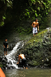
The cold nor the crowd deterred them from having a wonderful time. While Zeph jumped from rock to rock, Zeke was brave enough to swim across the pool to the waterfall all by himself. It was awesome to see the two of them having so much fun!


Thursday, June 10, 2010

*Mariner's Ridge*

Another great day with Zeke!

One hour to complete Mariner's Ridge even with a rest at the top. 
You never cease to amaze me... 


Monday, June 7, 2010

Maunawili Demonstration

Maunawili Demonstration Trail is a 10 mile one way stroll along the base of the Koolau Mountain Range from Pali Highway to Waimanalo. Of course not wanting to make this a 20 mile hike Beimes, Justin and I parked one car at a friend’s house in Waimanalo and then drove to the starting point at Pali’s “Hair Pin Turn” Lookout. This is, after all, our first hike in over a month and the first of our summer.

We exited the top of the Lookout's parking lot and walked along a trail heading steadily downward. It was wet and muddy and there were tons of mosquitos. We soon crossed a riverbed and back again, and then...the trail vanished. Obviously we had gone the wrong way, but what did we expect when the girl leading was the very one who didn’t read up on the hike?! As we back tracked Beimes referred to Stuart Ball’s The Hiker’s Guide to Oahu and learned we were supposed to head upward towards Old Pali Road, make a few switchbacks, and then pass a watershed. We climbed back up towards our starting point and spotted a pink ribbon. We searched further not wanting to go the wrong way again and finally someone, I think Beimes, spotted the correct path. I don’t know how we missed the trail but finally we were off on our 9.3 mile journey.

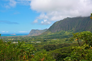
There's not much to say about Maunawili Demonstration Trail. It weaved in and out, crossed many small but dry riverbeds, and provided views of Kailua, Olomana, and Waimanalo. At the end, it was quite amazing to look back and see how far we came. We could actually see all the way to Chinaman’s Hat. However, that's about the only thing I found amusing because although the hike was easy, in my opinion, it was really long and mundane. The terrain rarely changed, there was no real challenge, and the views were so-so. With that said I will probably never do this trail again.